History of Send and Ripley
The History Of Send
The Evolution Of A Village
On Rocque’s map of 1768 there was no village of Send, just a few houses round the church and a few at Send Marsh plus scattered farms. There may have been no village but locally found flints show there was a settlement from pre-historic times. The well drained sandy soil, and the proximity of the river would have encouraged settlers but in all probability they would have only stayed while game and fish were plentiful and then moved on.
Close to the church
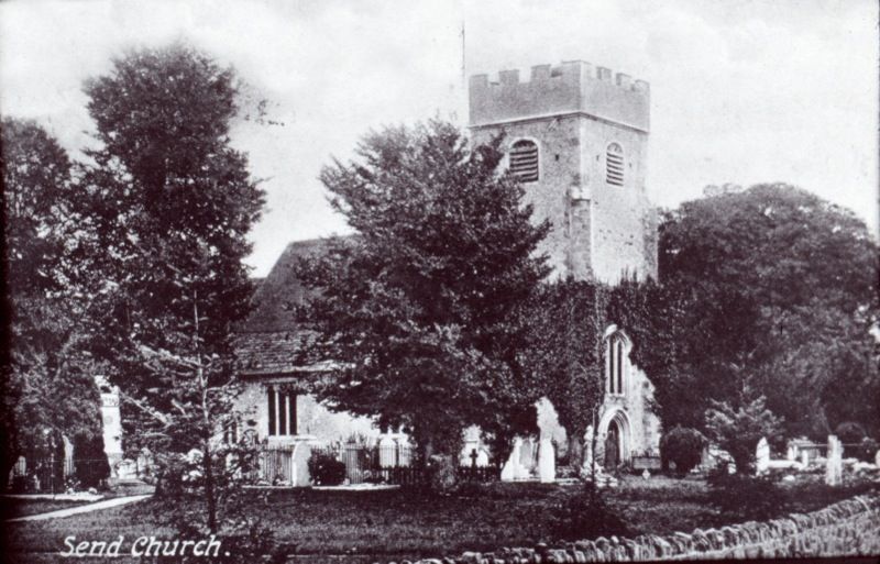
However at some point early man began to stay put and began farming. The rising ground, close to the river seems to have been an attractive spot for settlement. We know the ancient mound down Church Lane has had a place of worship for over a thousand years. There is reference to Sendan in a Saxon charter of 960-62 and also to a church in the Domesday Survey of 1086. The earliest part of the current church, the chancel, is thought to be c.1220 and the nave and tower, from the 15th century. However the church is down a narrow lane and although there were some houses around the church in medieval times, the geography of the site restricted the growth of the settlement especially with the River Wey close by.
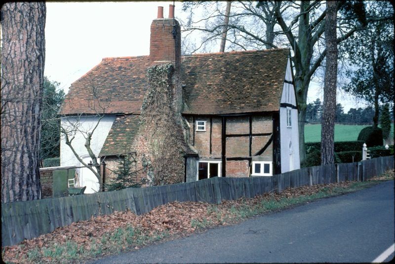
The old houses that are still in existence near the church include the Old Hall House, a 16th century timber-framed yeoman farmer’s house that now stands on the Send Grove estate. The house pre-dates Send Grove and was possibly empty from about 1600 until Send Grove was built around 1760. The Old Hall House may once have been used for brewing ‘Church-ale’ – possibly giving rise to rumour about a pub near the church.
Church-ale
Parish festivals were of much ecclesiastical and social importance in medieval England. The chief purpose of the church-ale (which was originally instituted to honour the church saint) and the clerk-ale, was to facilitate the collection of parish dues and to make a profit for the church from the sale of ale by the church wardens. These profits kept the parish church in repair, or were distributed as alms to the poor.
The churches must owe, as we all do know,
For when they be drooping and ready to fall,
By a Whitsun or Church-ale up again they shall go
And owe their repairing to a pot of good ale
“Exaltation of Ale”, by Francis Beaumont
Send Grove was built around 1760 as a home for Lt. General William Evelyn, great grandson of the diarist John Evelyn. He lived there until his death in 1783. We do not know if there were connections to the army camp on Send Heath at this time but it is possible. It was then bought by Sir Francis Samuel Drake, second in command to Sir George Rodney and descended from Sir Francis Drake’s brother. He married Pooley Onslow, sister of George Walton Onslow, the vicar of Send from 1792.
The Lodge to Send Grove is a small one bay Hall house at the top of Church Lane. Originally it was a farm cottage perhaps once owned by a farmer called Potter, hence Potters Lands and later Potters Lane. Later it became the lodge to Send Grove at the top of the drive.
Close to the church is Send Court Farm dating back to the 16th century. Who knows, there may have been other houses on Church Lane in medieval times, but only the Old Vicarage is there now. Although this small community was close to the Guildford Road (now Potters Lane) the lie of the land meant it was never an ideal area for a village to grow.
Cartbridge
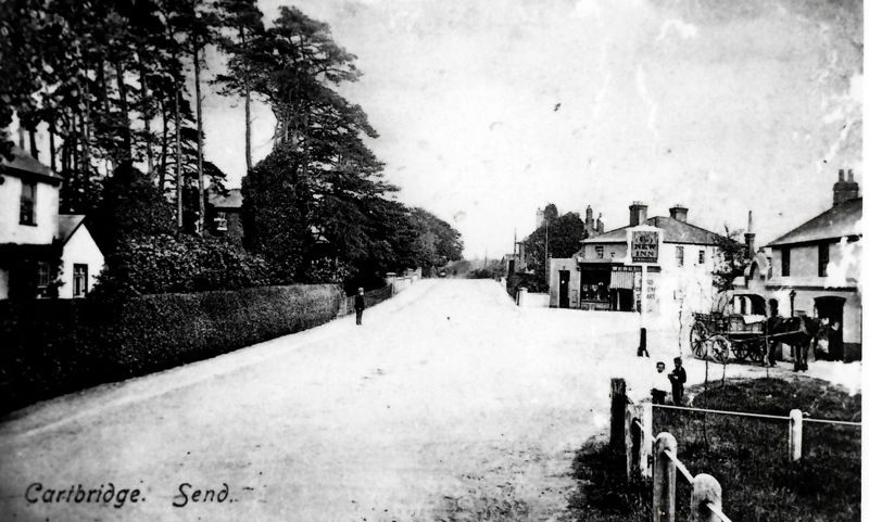
On the map of 250 years ago, a settlement at Cartbridge is non-existent. The road crosses the Navigation but the area is described as Send Heath and shows no housing. The area was used as a summer camp for troops but development came later. The Wey Navigation, built between1651-3, was a significant development for the growth of Send. Not only because of the navvies that built it, but because of the boat traffic on the Navigation which followed on from its construction. Slowly development grew up round the crossing point partly as a result of the Inclosure Act (1803) and Awards (1814-15). The map of 1897 shows houses running down to the towpath, in what is now Potters Lane.
At one point there were two public houses at Cartbridge, The New Inn and The Free Trader. The present New Inn was The Free Trader and the defunct New Inn on the opposite side of the street. For a short time there was also a third pub, Uncle Tom’s Cabin. There was a store until recent times on the corner of Potters Lane and Send Road and even a Post Office in Potters Lane close by the junction. However, once again the geography of the site affected its growth as both the river and the Navigation were restricting factors.

Send Marsh Green
On the 1768 map it is possible to see a little community at Send Marsh Green. Send Marsh Green is not an ancient name and it previously was called Kenning Marsh. The first mention of Send Marsh to have surfaced is in a deed of 1623 in which it refers to Maybanckes at “Send Mershe.”
Send Marsh Green, which extends to Aldertons, would have been common land probably low lying. There is no longer a pool but sometimes part of the Green is under water after heavy rain. Obviously it was not so low lying as to discourage a hamlet to grow up round the pond.
Old Manor Cottage is the oldest domestic building in Send and it has been dated to the first half of the 15th century. Other historic survivors are Send Marsh Cottage formerly Pullens Cottages, which dates from the18th Century and April Cottage, a typical smaller timber- framed house from the second half of the16th century. Corner Cottage is of similar period. What is now Willow Pool barn was the principal building in the former farm yard of Send Marsh Farm. Send Manor or The Manor House has had several names: Send Marsh Farm, Butchers Pond Farm, the Old Court House, High House and originally (probably) Mabanckes. The house was probably built c1670 for a Yeoman farmer, perhaps with other means, as the acreage of the farm seems to have never exceeded 37 acres.
These are the principal period buildings that survive and of course there are now many more modern additions but Send Marsh has managed to remain a distinct community.
Local farms
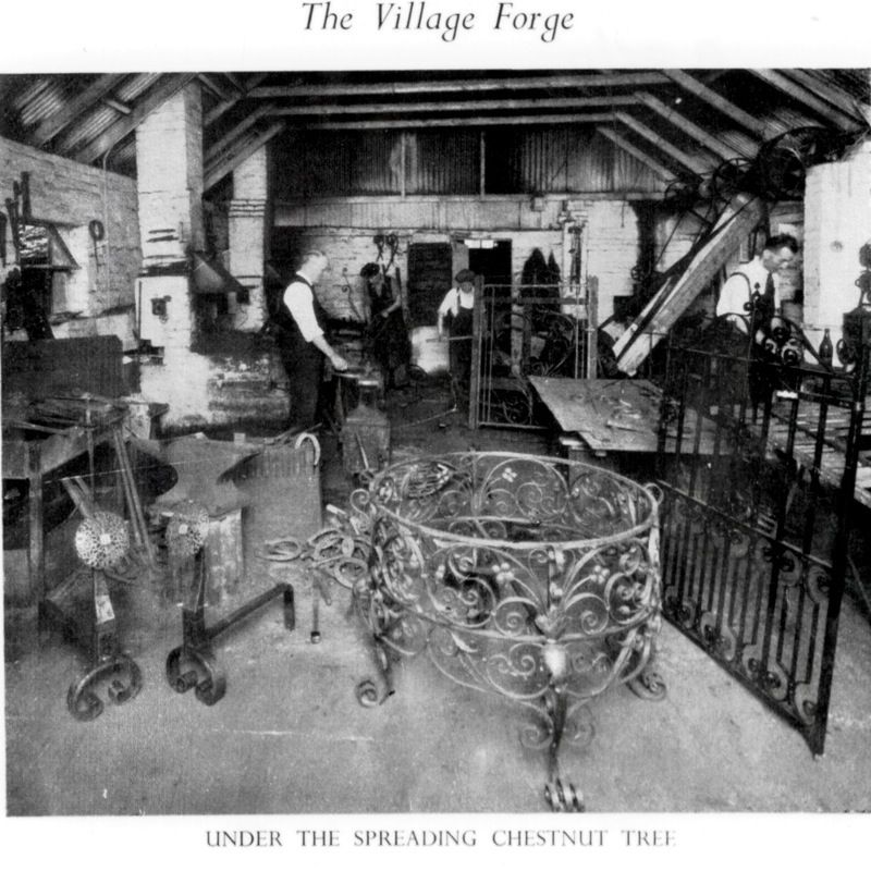
The area that we now call Send was basically heathland but surrounding areas were agricultural. As we have seen there was Send Court Farm down by the church. In Potters Lane there was Cricketshill Farm and across the field was Hillside Farm and what is now Aldertons at Send Marsh. Cottages, no doubt some of them tied cottages, would have been needed for agricultural workers. The farms also used horses and these needed shoeing and machinery needed mending and this led to another big step forward for Send –the smithy.
On the 1897 map there are still very few houses along what is now Send Road but the smithy is close to the crossroads. The other new innovation was the school on Send Hill. With more houses gradually springing up, there were more children. The Forster Education Act of 1870 meant that compulsory attendance at school ceased to be a matter for local option, as children had to attend between the ages of 5 and 10, with exceptions such as illness. However, apart from the road up to the school, in 1897 Send Hill is still marked as an unmade-up track which led from the church towards Send Marsh.
Other employers
Send is thought to be a corruption of the word Sand. Sand and gravel have been extracted all round Send from very early times. The light sandy soil has also been exploited for market gardening. Market Gardening was fairly labour intensive, at least on a seasonal basis. In the Second World War land girls provided much of the labour at Secrett’s market garden and prior to that, gypsy labour was used at peak harvesting times. As well as vegetables, cornflowers were grown for the flower trade –supposedly the buttonhole of choice at Ascot.
The Tannery was also at one time a local employer but perhaps because of the smell or just because of the need for water, it was situated on the edge of the developing village.
A much earlier employer was the brickworks, situated in Kiln Lane, between Send and Ripley. Despite the predominance of sandy soils, there are pockets of clay. Brick making would have provided building materials for the development of Send but also would have created employment.
The coming of the railway
However, the big game changer in the development of Send was the coming of the railway to Woking. The London and Southampton Railway was authorised on 25 July 1834. It was built and opened in stages, and the first section, that between the London terminus at Nine Elms and Woking Common (later just Woking) was opened on 21 May 1838. The road through Send became significantly more important as a route to the expanding conurbation of Woking.
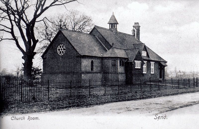
By 1920 one side of Send Road had been developed and the church rooms and the Institute (now the Lancaster Hall) built –slowly Send was being knitted together. Some of the houses were built for workers at the Gresham printing works in Old Woking. However, the large houses such as Ashburton House and Sendholme became viable as country residences for wealthy London professionals and businessmen because of the railway – the age of the commuter was born.
By the 1930s the recreation ground and the war memorial were in place. The wrought iron work for the memorial was made at the local smithy of C H Sex & Sons. The housing on the church room side of the road was mainly post war. This is relatively low lying land and it maybe, for this reason, it was late being developed. The worked out gravel pits off Potters Lane had been left as ponds and this may have helped drain the area somewhat. The growing population required more shops and the parade of shops near the rec was built.
More housing was built along Send Hill and this too took advantage of disused gravel extraction. Send Marsh Road between the crossroads and Send Marsh Green also saw increased development and the tentacle structure of modern Send was largely in place. So we can see that Send is a series of small settlements that gradually grew together over hundreds of years which it is why it is an ancient village with no historic heart.
History of Ripley
Local finds of flints, a bronze age and the Ockham horde indicates settlement prior to written sources. Ripley apparently means a copse or clearing in woodland. It is a roadside village possibly of Roman origin.
Ripley was originally part of Send and only became a separate parish in 1878. In 960-2 Send appears as Sendan in an Anglo Saxon charter. 1189-99. Ripley was first mentioned in a deed of the time of Richard 1st when a chapel of Ripelia was given to the Augustinians for their priory de Novo Loco ie Newark. That chapel, c1160, is chancel of Ripley church.
In 1360 the road through Ripley is shown on Gough’s 1st ever English road map. From approximately 1200AD until 1539 was the Monastic period where Newark Priory must have dominated life in the village. Henry III granted a Charter for a fair to be held on July 22nd, the feast of Mary Magdalen but it is not clear how long this lasted. Interestingly the current Summer Event is held on the nearest Saturday to July 22nd. The fair was held on the Green which is considered to be the largest village Green in England. The earliest houses were timber-framed with crown posts and one exists to this day. Vintage Cottage in Rose Lane has been dated by dendrochronology to the end on the 14th century.
After the Dissolution of the monasteries the priors of Newark were pensioned off or found other ecclesiastical posts. However Ripley did not decline, far from it as it was on the road to Portsmouth. Coaches would have stopped at the various Ripley Inns such as the Talbot and the George Inn. A legacy from this period can be seen in the names of the Ripley pubs: The Anchor, The Ship, The Jovial Sailor. Timber-framed houses, gradually gave way to brick.
English roads were in a bad condition and in 1749 a Turnpike Act was passed to improve the road from Kingston to Petersfield. There was a Turnpike just past the Jovial Sailor. As the road improved, the time for travel between Portsmouth to London reduced. Ripley became a post town and mail was brought to the Talbot to be put on the mail coach and landlords could be fined for not having fresh horses available. Mid eighteenth century saw the foundation of Ripley Cricket Club, thought to be the second oldest in the world. A local man Lumpy Stevens became the most accurate bowler in the country. When he bowled between the stumps (two stumps) without dislodging the bails, it was agreed to introduce a third stump.
Ripley’s significance as a thoroughfare reduced in Victorian times. In 1838 the railway arrived in Woking and in 1859 the railway was extended to Portsmouth. The coach trade reduced and the post was now taken to Woking to be transported by rail. However in 1869 the road through Ripley was given a
macadam surface which was ideal cyclists. From then until the early part of the twentieth century Ripley became “The most famous highway in the world”. “The Mecca of all good cyclists”, in the opinion of Lord Bury (later Earl of Albemarle).
From 1900 on Ripley has been dominated by the motor car. Tea shops abounded as motorists would take a run out to Ripley. In 1975 the situation had some temporary relief when the Ripley By-pass was completed. However the additional traffic in recent years has once again led to a lot of cars coming through the village, many en route to Junction 10 of the M25 (opened in 1984).
Two other personalities of note:
Kenneth White the pharmacist during WW2 is thought to have been the first man to make penicillin for civilian use –first unofficially and later with permission.
And Ripley’s most famous son, Eric Clapton known as slowhand
Send and Ripley have a long and vibrant History. The journals and newsletters written by the Society seek to explore and understand the past.